
Topographic Maps of Eastern Europe. An Atlas of the Shtetl. 18-20th Century.
Topographic Maps of Eastern Europe offers a collection of small and large scale historical maps of the lands of the former Polish-Lithuanian Commonwealth and the Pale of Jewish Settlement in late Tsarist Russia. Thousands of communities can be found in these images where our ancestors lived and eventually left.
How might we view the Pale of Settlement and the lands to the immediate west in their proper context as we search for the homes of our ancestors and their places of birth and death in previous centuries? Those who emigrated from this region left countries with boundaries completely different than those we see today. World War I and the Russian Revolution caused these boundaries to change radically after about a century of stability. Within this context here are thousands of maps giving various views of the land from late eighteenth through the early twentieth century. Small scale atlases and gubernia maps reveal a vast area conquered and re-divided by the leaders of Prussia, Austria, and Russia at the end of the eighteenth century. Lands were further divided after the Congress of Vienna in 1815 and the resulting borders would remain, albeit with minor shifts, until the dissolution of the Pale in 1917.
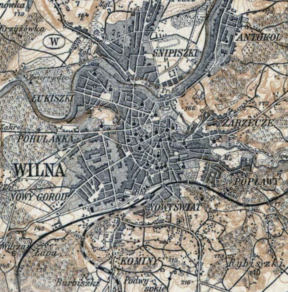
The large scale topographic series included here show us communities of all sizes down to the smallest villages putting to rest the notion that some were too small to be found on maps. Even evidence of Jewish presence is given by specific symbols on many of the maps. Some, like cemeteries are obvious and others like taverns more subtle. Along with the symbols these maps show us national, provincial and administrative boundaries that limited Jewish residence and formed a basis for the gathering of records, collecting taxes and drafting military conscripts. Within these boundaries legislation specifically designed to limit the rights and freedoms of Jews would bear profoundly on their lives. Military conscription, pogroms, crowding, poverty and expulsions all combined to motivate massive migration and political movements within and out of Eastern Europe.
People worldwide are searching for their origins and maps are an important tool in that search. Throughout the U.S. and Europe there are libraries and archives that contain thousands of historical maps useful to genealogists and historians. Maps from earlier centuries stored around the world can now be seen with a click. This website may offer surprising discoveries for those who are searching by providing a central gathering point of historical geographic information. We are indebted to the collections around the world and the work of others whose websites and articles are linked here, joining with the maps to form a practical set of research and learning tools. The nature of Jewish communities, of shtetlech and their relation to the changing national boundaries are all questions which Topographic Maps of Eastern Europe can address, giving viewers a clearer sense of place as they search for the homes of their ancestors and ponder life in the shtetl.
[Illustration: Screenshot from the Wilna section (Q-23) of the Karte des westlichen Russlands. At the scale of 1:100,000 these maps reveal a wealth of information. Jewish cemeteries are frequently represented on these maps and occasionally synagogues. A large Jewish cemetery is identifiable in this section in Zarzecze, a suburb north-east of the Wilna city center . Map courtesy of U.C.Berkeley.]

Geographical area
Published : May 17, 2021