Logo

Online Primary Sources

  • Home
  • All Sources
  • About
  • Newsletter

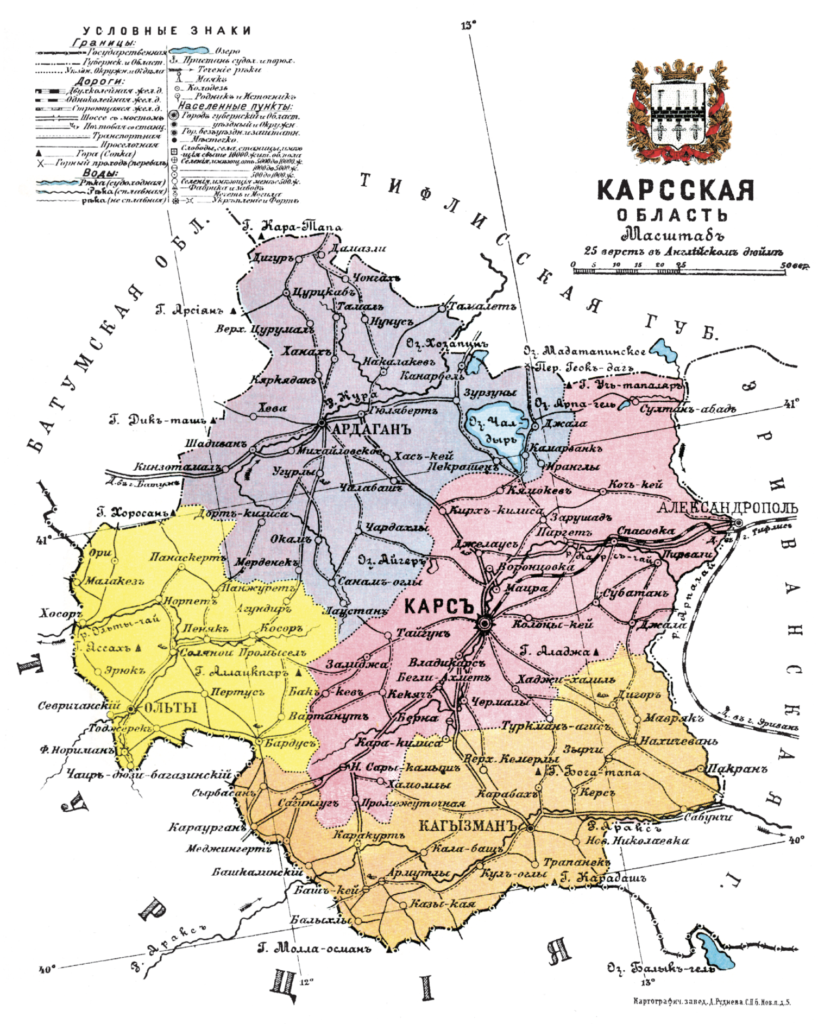
Maps of the Russian Empire by Provinces and Regions, 1913


Institution

Wikimedia Commons

Url

https://commons.wikimedia.org/wiki/Category:Atlas_of_the_Russian_Empire_(1913)

Russia. Geographical description of the Russian Empire by provinces and regions with geographical maps. St. Petersburg: "Lean" Printing House, 1913.

Отпечатано в картографическом заведении Д. М. Руднева в Санкт-Петербурге. - II. Азiатская Россiя. XV. Кавказскiй край. - Карсская область, стр. 76 // Россiя. Географическое описанiе Россiйской Имперiи по губернiямъ и областямъ съ географическими картами. Санкт-Петербургь: Типографія "Бережливость", 1913


[Illustration:  II. Asian Russia. XV. Caucasian region. - Karskaya oblast, p. 76 //]


Type

Image

Geographical area

Imperial RussiaOttoman EmpireRussian Empire

Period

20th century

Language

Russian

Keywords

atlasempiregeographymapsprovincesregions

Published : February 16, 2024

Share this source

Send by email

Share this source by email or save it by sending the data to your mail box.

Newsletter

Receive the latest sources each month

By clicking on the Subscribe button, you confirm that you have read our Data Protection policy.
Logo cnrsLogo ehessLogo cercec

The Online Primary Sources database is curated by
the french Centre for Russian, Caucasian and Central European Studies (CERCEC), a CNRS-EHESS joint research unit.

  • Credits
  • Legal Notice
  • Data Protection