
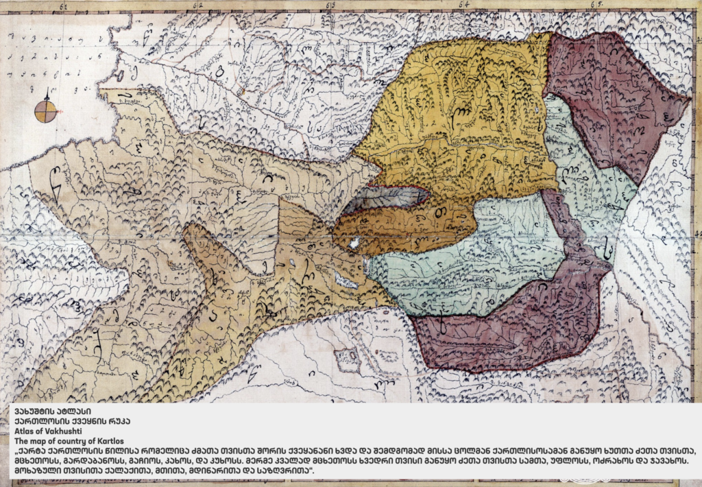
Geographical Atlas of Vakhushti Batonishvili, 1743-1755
"Description of the Georgian Kingdom" and the Geographical Atlas of Vakhushti Batonishvili are unique manuscripts which represent the first attempt at a complete description of the Georgian territory. Georgian territory. The history and geography of the country are gathered in one book.
The geographical atlas is a valuable cartographic heritage not only for Georgia but for the development of Georgia but for the development of the culture of the countries of Europe and Russia.
"Description of the Georgian Kingdom" and the Geographical Atlas are manuscripts of Vakhushti Bagrationi made between 1743 and 1755. According to the author's summary, it appears that the maps and family trees were an integral part of the manuscript. Later the extracted (apparently in the 19th century) and bound separately to make the "Geographical the "Geographical Atlas". The maps are made on the same paper as the text of the book. It specified that the maps were part of the work: the geological descriptions of each region were followed by the region were followed by the specific map, which was inserted later by the author, once the work was completed.
Vakhushti Bagrationi was a Georgian prince, geographer, historian and cartographer, son of king Vakhtang VI. In 1724 the king Vakhtang VI left for Russia with his suite and his son Vakhushti. The prince settled in Moscow during his immigration. After his death, "Description of the Georgian Kingdom" as well as the Atlas were bought by the Asian museum of St. Petersburg in 1838 from Konstantine Bagrationi (1793-1844; son of King David of Imereti), owner of the document at that time. As the Atlas was the property of the St. Petersburg Asian Museum, it was called "Petersburg Atlas". In 1925, the Saltikov-Shchedrin Library of St. Petersburg transferred "Description of the Georgian Kingdom" and the Atlas of Vakhushti to Georgia, they are preserved in the Central Historical Archives of the National National Archives of Georgia.
Vakhushti's maps are distinguished by the completeness of their topographic details compared to the rest of than the rest of the cartographic images compiled before and/or after and since the beginning of topographic surveys. According to the researchers, the Vakhushti Bagrationi maps have played a special role in the study of the geography and cartographic descriptions of the Caucasus and the Georgian territory. This is how Europe became familiar with the Caucasus by consulting cartographic images of Georgia and the neighboring territories contained in these maps.
[source: http://www.unesco.org/]
Published : May 03, 2021